

On This Page
Trip Snapshot
Objective
To check out as many state and national parks as possible.
Luckily, for the time being, many of the geological wanders in the state are protected as Utah is a mecca of state and national parks.
Park Admission
If you are planning on passing through, you may want to consider purchasing a national park annual pass. A pass will get you into all national parks, national monuments, federal lands, and is usually more economical than paying the entrance fee at each individual park.
The pass covers the entrance fee for your entire vehicle, not just the pass holder.

For more info on national park passes or to purchase one online click here.
When We Went
September 2017. Days were hot, nights were cool.
Length of time
We spent two days in Utah as part of a larger road trip.
In total, we made a ten day, 4,000-mile journey through five different states across the American Southwest. It took a whopping 55 hours of driving time to complete and literally doubled the amount of miles on the rental car.
(Texas> New Mexico> Colorado > Utah> Arizona> New Mexico> Texas)
Due to the limited amount of time we had to complete our trip, there were some parks we were only able to catch a mere glimpse of when we could have easily spent an entire day, heck an entire weekend, hiking and exploring. We had to prioritize, cut a couple of things short, and even skip a few things altogether.
Map
Here’s where we were in Utah:
Elevation
This area of Utah is known as the high desert, we were at an elevation of 3,000 to 9,000 miles above sea level the whole time we were in the state.
Neither of us had any problems adjusting to this altitude. This did cause it to cool off at night however, so throw a couple of extra layers in your bag.
How We Got Around
Plane
We flew into and out of Austin, Texas, the beginning and ending point of our road trip.
Rental Car
Once we landed, we picked up the rental car and hit the road.
Where We Stayed
We used Airbnb and booked where we would be staying each night ahead of time.
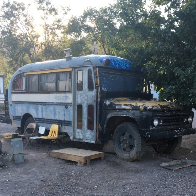
One goal we had on this road trip was to stay at the most interesting Airbnbs we could find. We achieved just that by booking a stay at Mystic Mike’s Hot Springs Resort in Monroe, Utah.
Mystic Mike’s
We pulled up to the main office to check in. It was a dimly lit shop of incense, fringe-trimmed garments, and other various oddities. Mike greeted us and told us where to find the bathhouses, our bus, and of course the hot springs.
The whole place had a grungy feel and was covered in hippies.
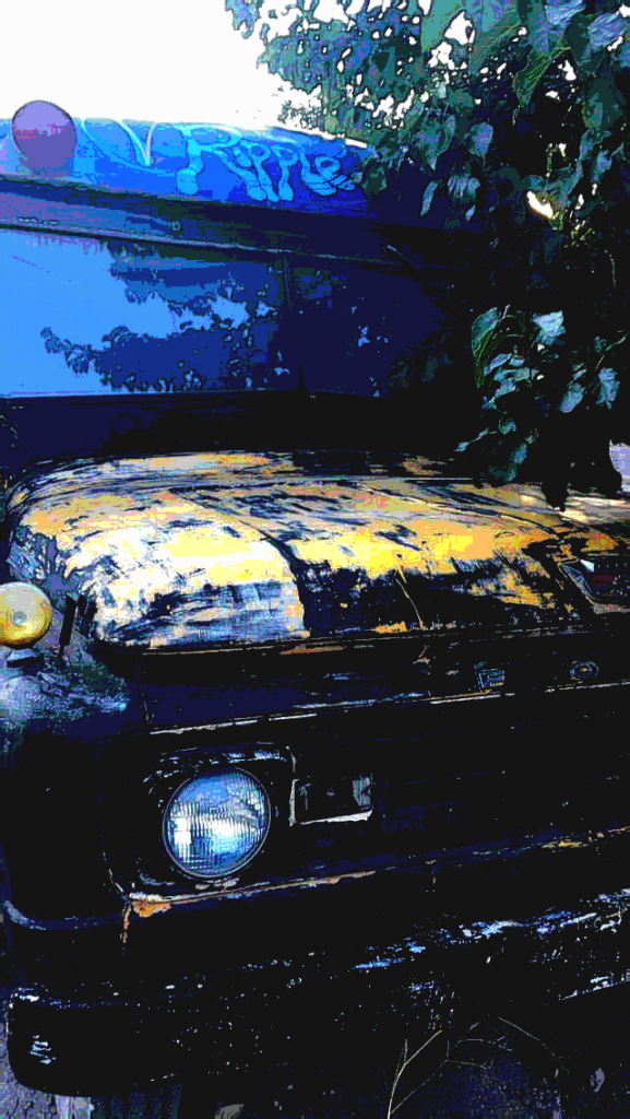
We went over to the row of renovated buses to find our very own, the Ripple Bus:
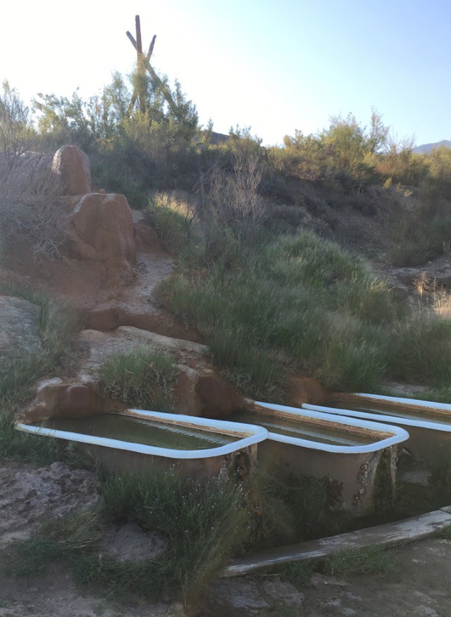
After unpacking our things we headed for the hot springs. The natural springs ran down a hill, fed into three bathtubs on the upper level (yes, outdoor bathtubs), and all emptied out into a large pool down below.
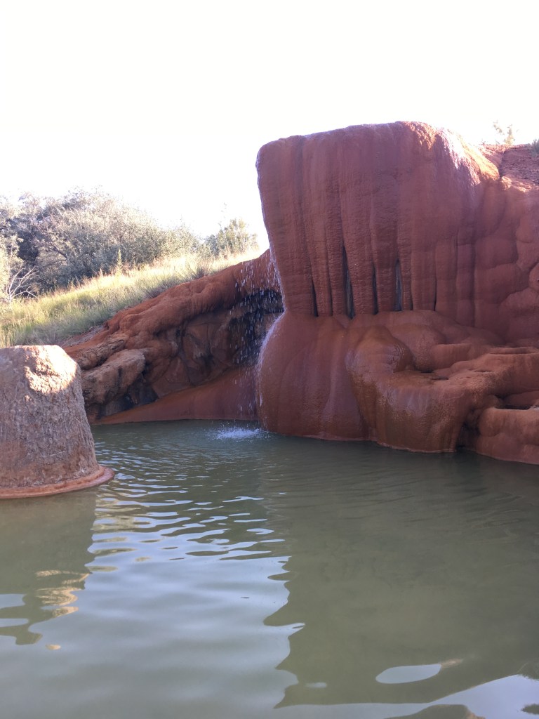
All said and done, Mystic Mike’s was a laid back place to crash after a day of hiking.
What To Pack
We spent all day hiking at various parks.
Most places we went to were very open with little to nothing to block the sun.
It was hot. Be prepared.
- Wear cool, comfortable clothing
- Bring a hoodie or light jacket for when the sun goes down
- A good pair of walking/ hiking shoes
- Plenty of sunscreen
- Bring some sunglasses
- A reusable water bottle, national parks are great for having convenient refilling stations.
- A cooler with snacks
What We Did
- Arches National Park
- Goblin Valley State Park
- Capital Reef National Park
- Bryce Canyon National Park
- Mt. Carmel Scenic Byway
- Zion National Park
- Coral Pink Sand Dunes State Park
Westbound On Highway 62
We had just spent the night in a teepee up in the Rockies of Ridgeway, Colorado, and were headed west on highway 62 with our eyes on Utah.
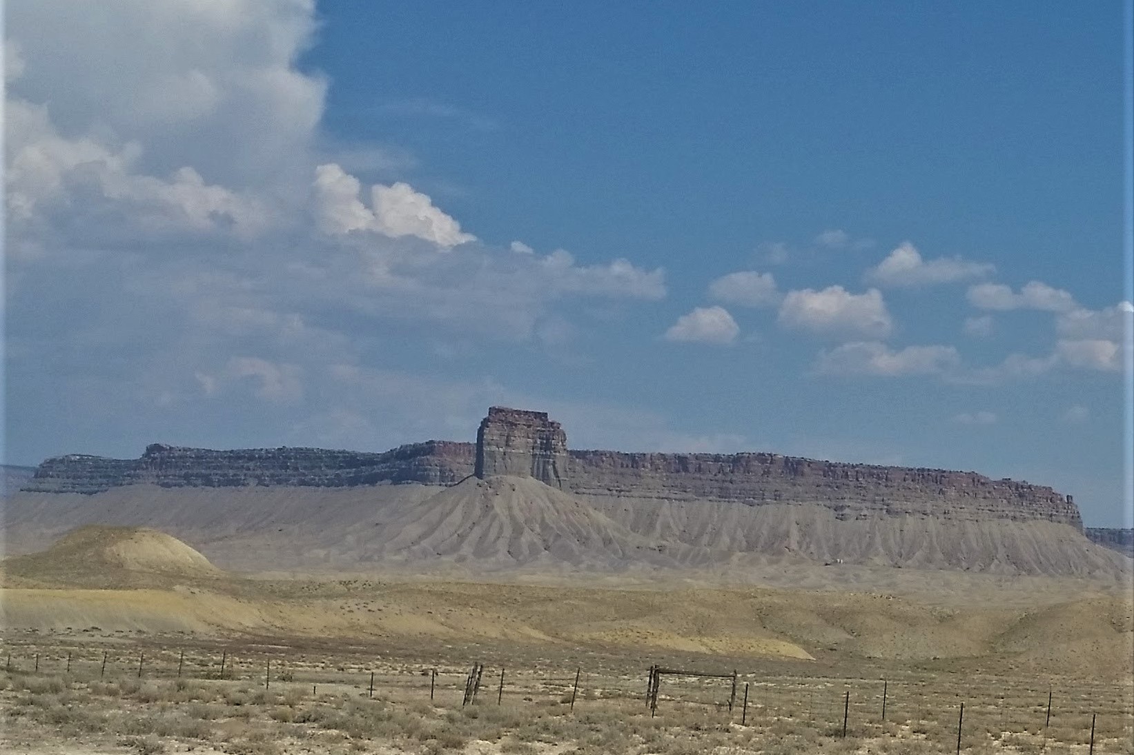
The Landscape of Utah is Bizarre
From the top of the table-like plateaus to the bottom of the deepest canyon, trekking through Utah is like taking a journey through the geological history of the Earth.
Every feature you come across is as much awe inspiring as it is mind boggling, and is typically the result of millions of years of erosion and other weathering processes at play.
Arches National Park
The first park we arrived at was none other than Arches National Park.
You can find more information about the park here.
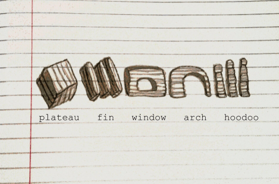
Sandstone Erosion
Arches are a unique, natural phenomenon. The process begins as giant sandstone plateaus are slowly eroded away. First, they typically separate into parallel strips of rock, or fins. As they continue to be worn down, windows emerge. They can eventually become thinner and elongated pieces, forming the delicate arches. Finally, all that remains are the remnants of the slabs that once were, called hoodoos.
Here’s my doodled diagram:
There are a variety of trails in the park that allow you to observe all stages of this erosion process up close and personal.


You must check out the picturesque Balanced Rock.
And shuffle in between magnificent sandstone fins of the Fiery Furnace.
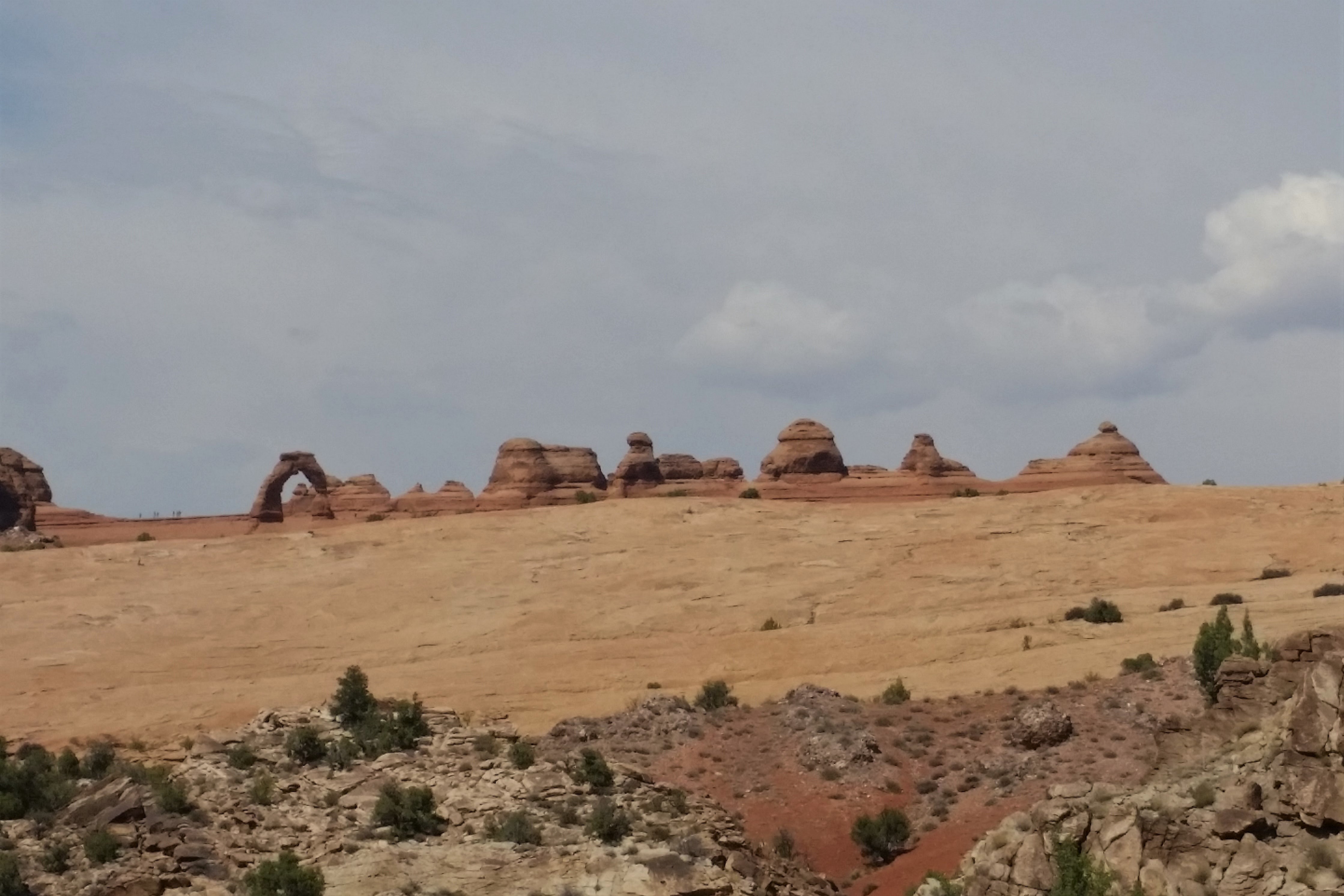
Delicate Arch
Delicate Arch, that picturesque, iconic arch you find adorning everything from t-shirts to license plates, was a must stop. The picture below was taken from a viewpoint, however, there is also a trail that will take you right up to it for a better view.
A Newly Discovered Fear of Heights?
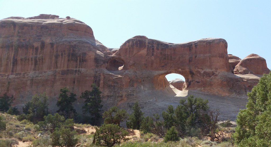
We hiked to the fragile Landscape Arch at Devil’s Garden, and even proceeded on to the continuing trail to catch a glimpse of the famous Double O Arch. I never thought I had a fear of heights before, but something about hiking near the edge of a narrow rock overhanging with nothing but boulders between myself and the ground below made my stomach drop out. I had the sudden urge to lower my center of gravity. I literally crawled part of the trail.
We had a little time to kill before it was time to check into our Airbnb for the night, and a couple of rangers recommended we check out Goblin Valley State Park. We hopped on the 24 scenic byway to get there.
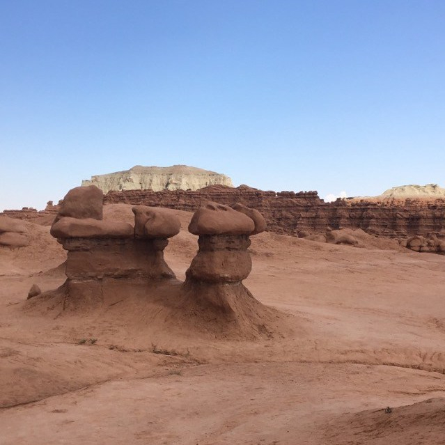
Goblin Valley State Park
Goblin Valley State Park is how I would envision the surface of Mars to look like.
Check out their website here.
A great valley littered with strange mushroom-shaped formations, known as goblins.

We learned that long ago this was the sight of an ancient sea and these goblins are all that remain.
We wandered among these absurd chunks of rock, unable to grasp that this place actually exists.
It felt surreal.
Among the Darkest Places on Earth
At night, it is one of the darkest places on earth. We happened to be there during a full moon, so were not able to do any star gazing.
Next time I travel to the Southwestern United States, it will be for a cosmic event.

A Perplexing Round of Disc Golf
While exploring this puzzling place, we stumbled upon a disc golf course. It zig-zagged it’s way around the goblins in seemingly no recognizable pattern.
It was the most confusing course I’d ever seen, and added to the peculiarity of the park as a whole.
We were seriously unable to locate hole #1 so Alex just threw at whichever holes he could find.
Capital Reef National Park (Abridged)
After Goblin Valley State Park, we got back on 24 and drove alongside Capitol Reef National Park. We did not have time to actually go inside the park, but even the drive around was quite impressive.
As a general rule, I always opt for the scenic route.
Bryce Canyon National Park
At long last, we reached the canyons, Bryce Canyon National Park.
Find more information about the park here.

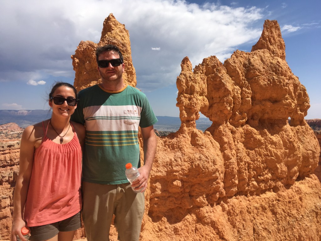
Bryce Amphitheater
You’ll remember from our discussion earlier that hoodoos are the last stage of the sandstone erosion process.
Shortly after entering the park, you happen upon the magnificent Bryce Amphitheater, which boasts the densest collection of hoodoos in the world.
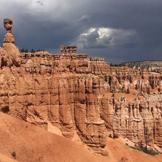
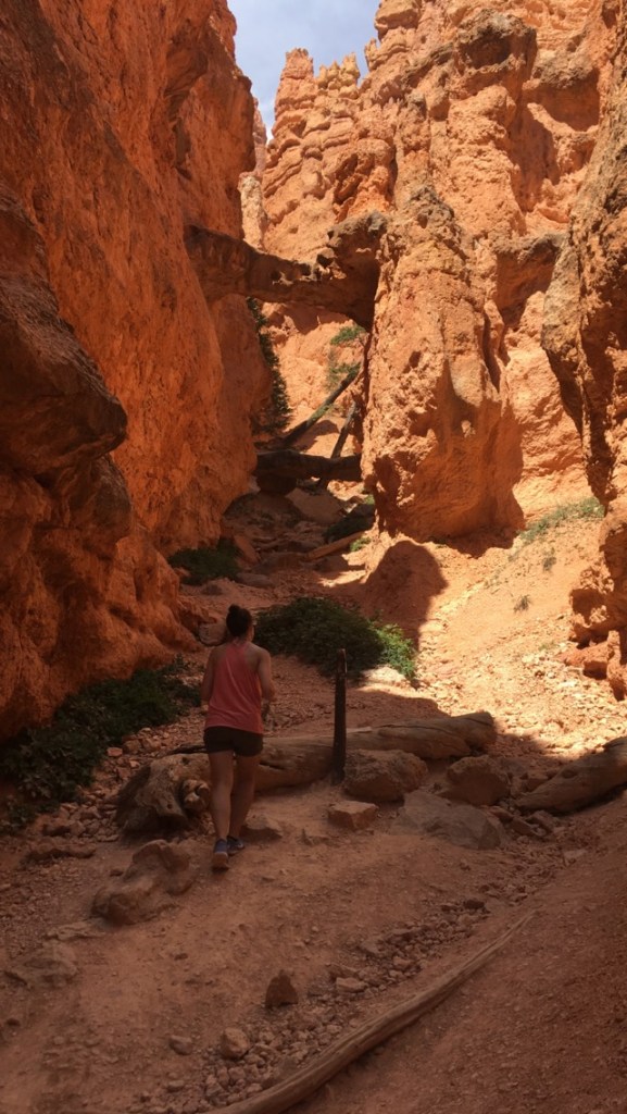
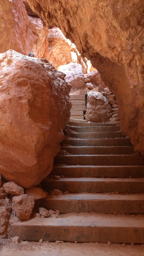
We hiked the Queen’s Garden/Navajo Combination Loop off Sunset Point, which took us down into the canyon.
Picture stepping into an inverse mountain.
Down and around you go for quite some time. When you finally stop to look up all you can see is giant slabs of red rock towering high above your head.
On this trail we were able to view a few other geological spectacles, including Thor’s hammer and Two Bridges.
This hike might just take the #1 spot of the trip for me, and was moderate enough that we saw people of all ages.
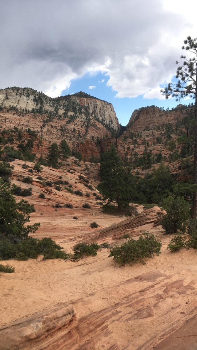
Mt. Carmel Scenic Byway
We continued south on 89 until we reached the Mt. Carmel Junction, which hooked us up with the Mt. Carmel scenic byway.
It zigzags its way around the vast slabs of sandstone and even takes you straight through one in the form of an impressive 1.1 mile-long tunnel. (An interesting tidbit about this tunnel – if you have a large vehicle or an RV, you’ll need to call ahead and get traffic control as it was built before these kinds of vehicles were prevalent.)
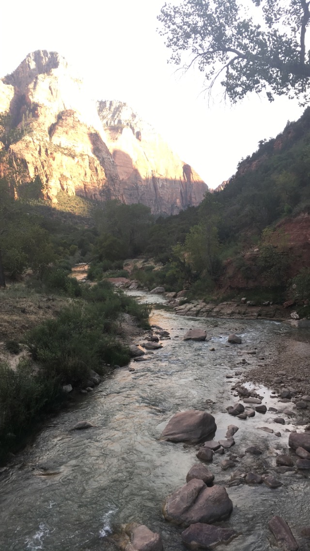
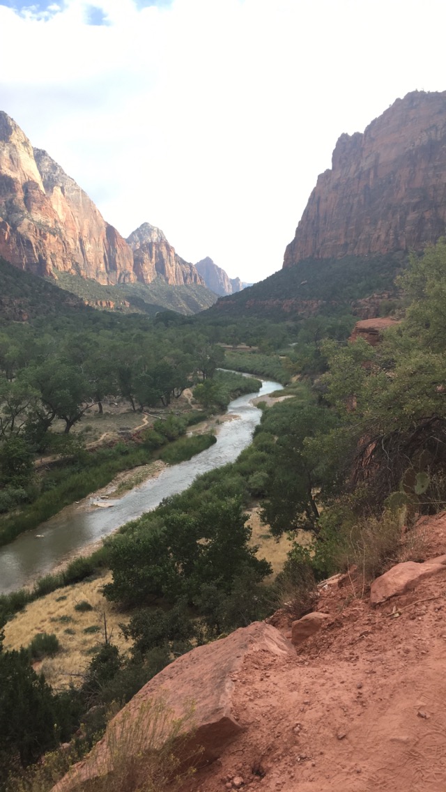
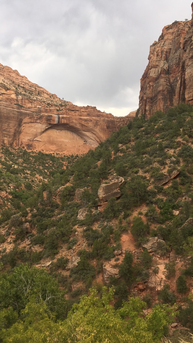
Zion National Park
And then you enter Zion National Park
Check out the park website here.
The Mt. Carmel scenic byway takes you in the east entrance of the park where you enter at a point of higher elevation and you continue weaving your way all the way down.
It’s an amazing drive. We pulled off quite a few times for the sole purpose of getting out of the car to gawk at the scenery around us.
We were completely surrounded by giant boulders.
At one such stop a we caught a glimpse of a few goats staring at us, their heads cocked to the side as they stood grazing nonchalantly at an easy 45 degree angle a good 20 feet up in the air.
Once inside Zion, you park your vehicle and take a shuttle to the areas you’d like to explore further. (There is a period during the off season when the shuttle does not operate and you are allowed to drive your own vehicle throughout the entire park.) We took the shuttle to catch a glimpse of some of the main attractions and even passed by some rock climbers scaling the famed Angels Landing. We got out at Zion Lodge and hiked The Grotto and Lower Emerald Pools.
Zion was Alex’s favorite park of the trip. It was truly breathtaking.
Coral Pink Sand Dunes State Park
Our last stop before leaving the magical land known as Utah was Coral Pink Sand Dunes State Park.
Check out the park website here.
It is exactly what the name implies.
1,200 acres of coral pink sand (or orange depending on the time of day and amount of sunlight hitting the dunes).
The giant sandbox is formed as wind carries eroding Navajo sandstone and deposits it in the valley. The result is a constantly shifting, pink powdery landscape. The sand was extremely fine in texture, making it soft to the touch and easy to shake off.
I’d love to explore this park on a 4-wheeler.
Onward to Arizona
Coral Pink Sands is located right along the Utah-Arizona border, which was to be the next state we would explore in our Southwestern adventure.
