On This Page
Trip Snapshot
Objective
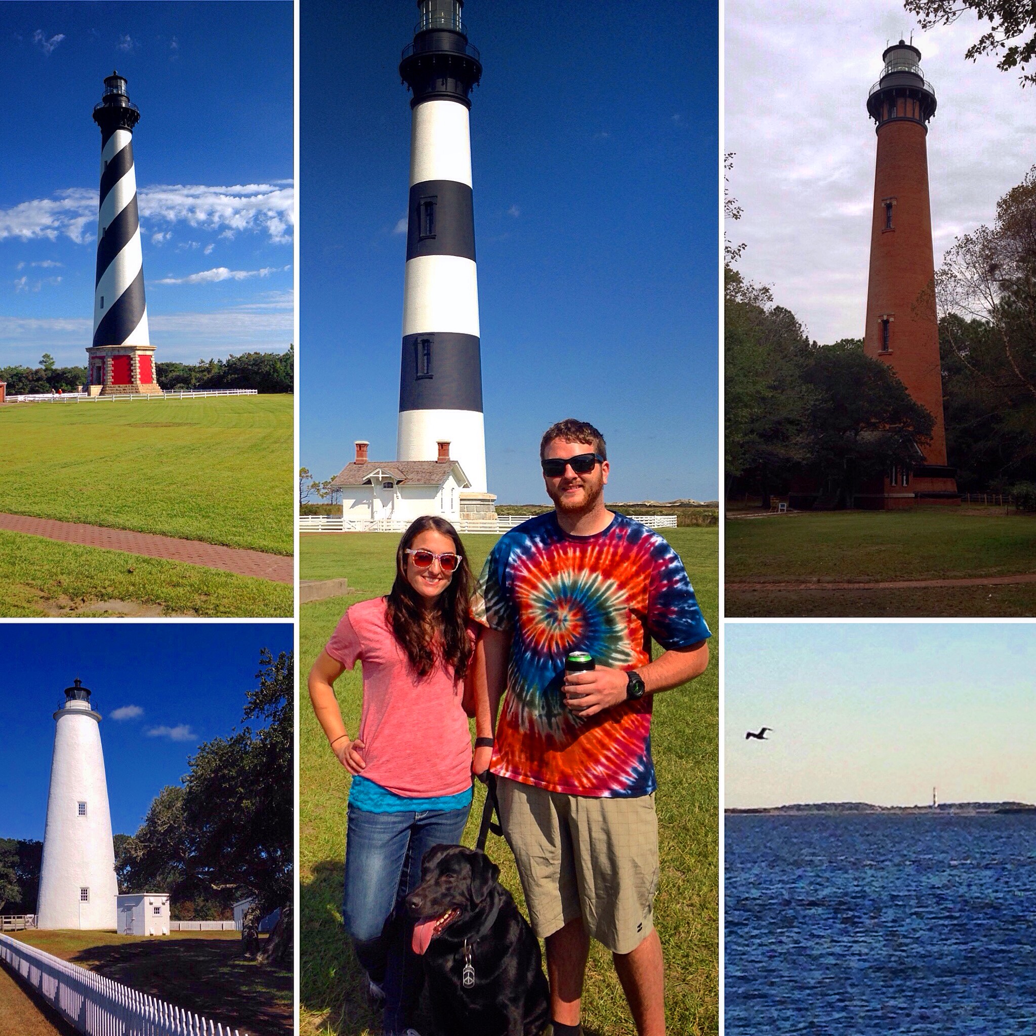
There are 7 lighthouses along the North Carolina coast, 5 of which are located on the barrier islands, an area known as the Outer Banks.
Our mission was to see all 5 Outer Banks lighthouses.
When We Went
October 2015. The weather is mild this time of year. Jeans and a sweatshirt is the most you’ll need.
You can view any of the lighthouses at any time of year of course, but if you’ve got your heart set on climbing to the top you should check beforehand and see what each allows. Most of the lighthouses that are open for climbing do so from mid-April through mid-October (ish).
Another general rule of thumb for any beach town on your route is that many areas/activities will be shut down during the off season (with the peak season being Memorial Day through Labor Day), so look up this information before you go.
Length of time
We took our time and spent four days completing the tour.
Take it slow, enjoy the ride.
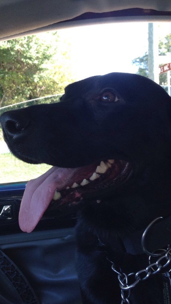
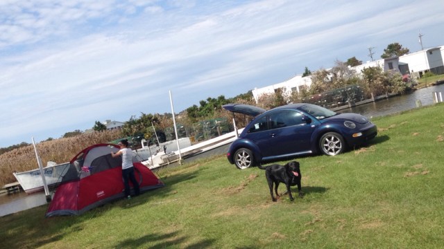
Dog-Friendly Trip
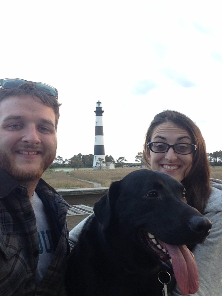
We brought our black lab, Bocephus (Bo), on this trip. Many places we went were dog friendly, but he had to stay in the car for a few things. (It was not hot outside and he loves car rides.)
Map
Here’s the route we took to see all five lighthouses (as well as a few other activities):
How We Got Around
Car
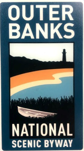
It was a mini road trip of the North Carolina coast, with the majority of the route being on Highway 12, the Outer Banks Scenic Byway.
Every resident of the Outer Banks has “OBX” as the first three characters on their license plate, so despite being North Carolina residents ourselves, I’m sure we still stood out like a couple of shoobies.
Ferry
In order to see all five Outer Banks lighthouses, you will be required to catch a couple of ferries. You will not be able see the Ocracoke or Cape Lookout lighthouses without taking a ferry.
Normally the ferry system operates several times a day pretty much year-round, but individual routes can vary due to weather, maintenance, and other factors. If this sort of transportation is new to you, it would be a good idea to familiarize yourself with these routes beforehand.
Check out the North Carolina Ferry Schedule here.
Where We Stayed
Camping In The OBX
We camped at various locations along our self-guided tour.
We found our camping spots on the fly, the day of.
Keep in mind some campsites may have limited availability or only be open seasonally.
Here’s a little bit more about some of the spots we stayed:
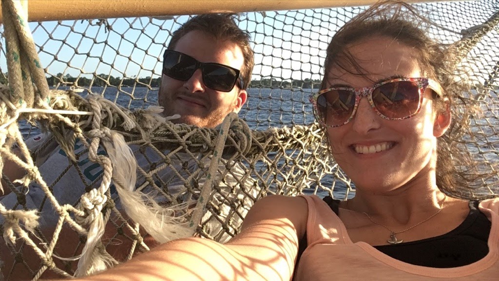
A Sailboat In Little Washington
We spent our first night on a sailboat in little Washington, a quiet, low-key sailing community in Beaufort County, North Carolina.
Joe and Kay’s Campground
Our second night we stayed at Joe and Kay’s Campground, located in Kill Devil Hills. It was just your basic campground. Nothing special. Adequately priced. Quiet. There were several RVs on site, but we were the only tent campers.
Cape Hatteras National Seashore Campground
On our third and final night, we camped on Cape Hatteras National Seashore.
There are multiple camping locations along the Cape Hatteras National Seashore, and our spot in Ocracoke was amazing, one of my favorites.
Find more info on the campground here.
We were situated right on the other side of the dunes and could hear the waves crashing during the night.
Rent a Beach House
If you’re not into the whole camping thing you can just as easily rent out a beach house. We have done it this way on several occasions.
Food
Coffee Caboose
In Little Washington, we stopped in the Coffee Caboose, a former railroad building that has since been converted into an adorable coffee shop. A must-stop if you need a little pick-me-up.
Update: I recently found out that the Coffee Caboose has since closed down *sad face*.
The Kill Devil Grill
We sampled as much fresh, local seafood as we could on this trip.
Named after its location in Kill Devil Hills (one of several charming little beach towns we passed), we stopped here to eat solely because of the name. Although it may look like just your standard diner from the outside, don’t be fooled, they serve the best, melt-in-your-mouth crab cakes. THE BEST.
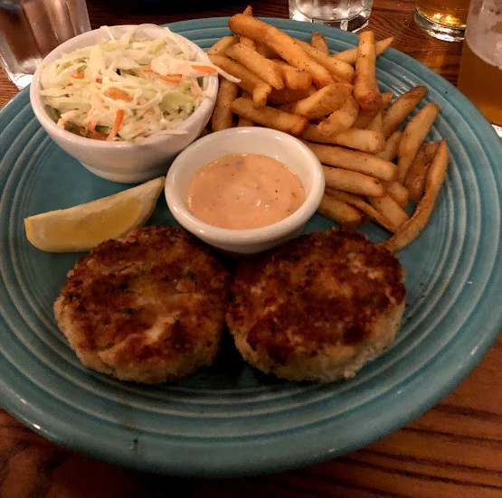
I’ve seriously never had a better one anywhere. They use all meat and no filler, which makes them quite pricey, but also so delicious and so worth it.
Check out their website here.
What We Did
- Digger’s Dungeon
- Currituck Beach Lighthouse
- Wrights Brothers National Monument
- Jockey’s Ridge State Park
- Bodie Island Lighthouse
- Outer Banks Seafood Festival
- Cape Hatteras Lighthouse
- Ocracoke Lighthouse
- Cape Lookout Lighthouse
A Lighthouse Scavenger Hunt
Originally, the lighthouses served as guiding beacons of light for sailors braving this treacherous stretch of ocean, infamously known as the Graveyard of the Atlantic. The shallow water and constantly shifting sand of the shoals made this area perilous for many.
Visiting them all was like a scavenger hunt.
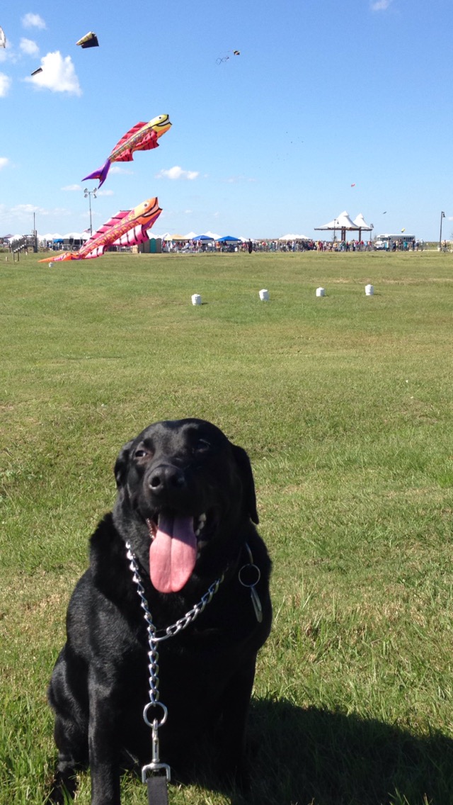
Bo started off the trip breaking the rules. He’s a wild one.

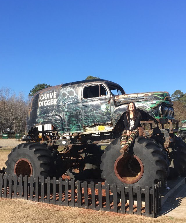
Digger’s Dungeon
If you go a bit North of the lighthouse path (but not too far), you can see the monster truck, Grave Digger.
Take a look at his website here.
His home, “Digger’s Dungeon”, is located off the Caratoke Highway in Poplar Branch. Alex was a die-hard fan when he was a kid, so we had to make a pit stop. There are several other retired monster trucks as well as a gift shop.
Time to get back on track and see the first lighthouse.
Next stop: Currituck.
Currituck Beach Lighthouse
The first and northernmost lighthouse of the trip, the Currituck Beach Lighthouse, said to be comprised of one million bricks.
Check out the website here.
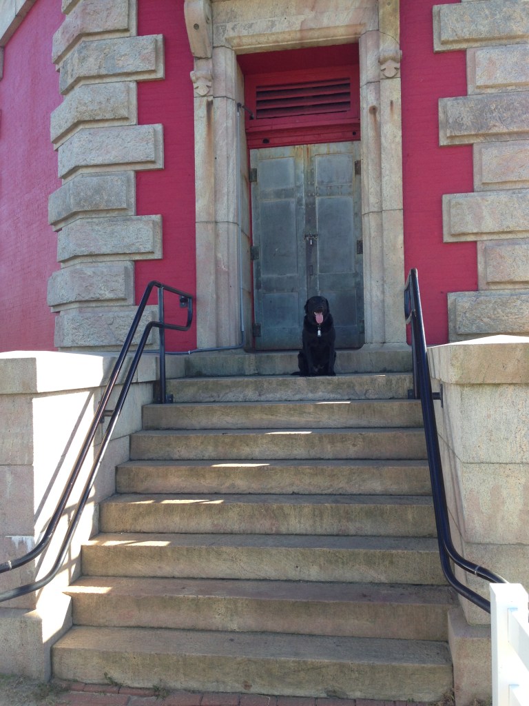
We purchased a couple of passes at the station to climb it (it wasn’t too expensive, under $10 a piece, and proceeds go towards maintaining the tower). This is the only lighthouse we ended up being able to climb on our tour. (Bo had to stay in the car for the climb.) Outlined by a black rod-iron spiral staircase, there are over 200 stairs. A circular platform at the top gives you a nice vantage point of the town and sound below.
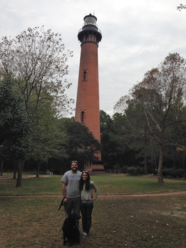
One down, four to go.
Wright Brothers National Monument
A bit further down the road from Currituck and we were at the Wright Brothers Memorial, a commemoration to the historic flight. Yet another one of North Carolina’s claims to fames.
Check out the monument’s website here.
It wasn’t particularly striking visually to me, it’s more so one of those places you have to really take in and think about what occurred there to really appreciate how monumental and influential of an accomplishment it was in its time.
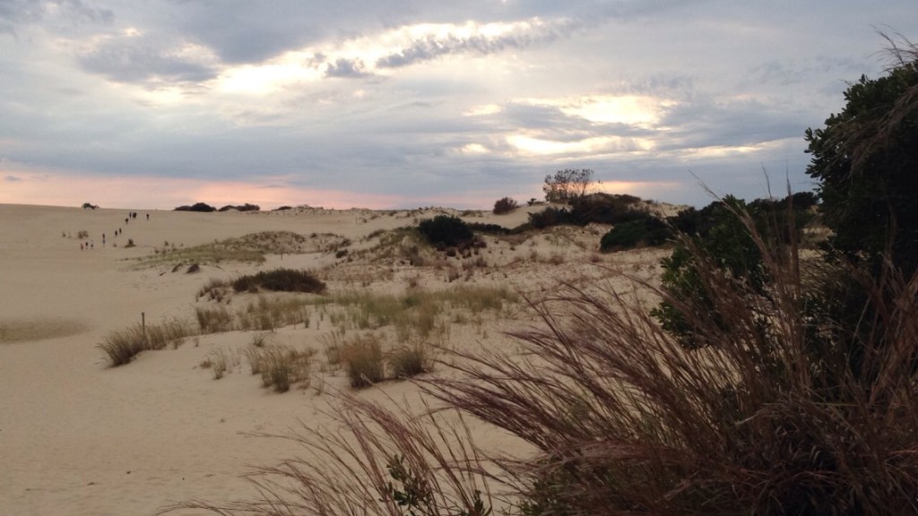
Jockey’s Ridge State Park
A giant system of sand dunes covering a whopping 426 acres, this park has the tallest active sand dune system in the eastern United States.
Check out the park website here.
The park is dog-friendly, so Bo got come.

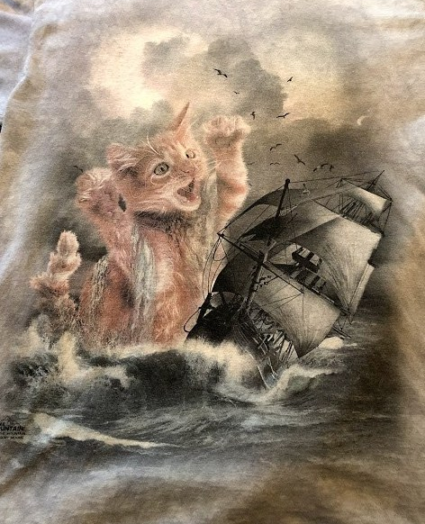
Kitty Hawk Kites
Right down the road from Jockey’s Ridge is Kitty Hawk Kites, your typical tourist shop. This one’s famous for its bright yellow exterior and colorful kites.
Check out this sweet t-shirt Alex picked up:
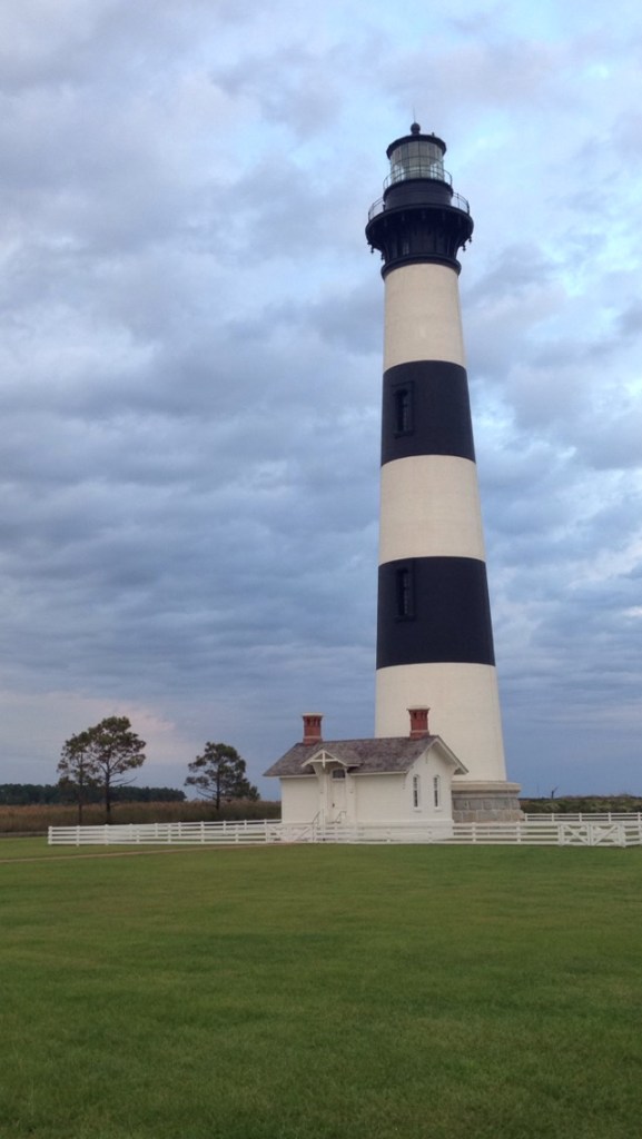
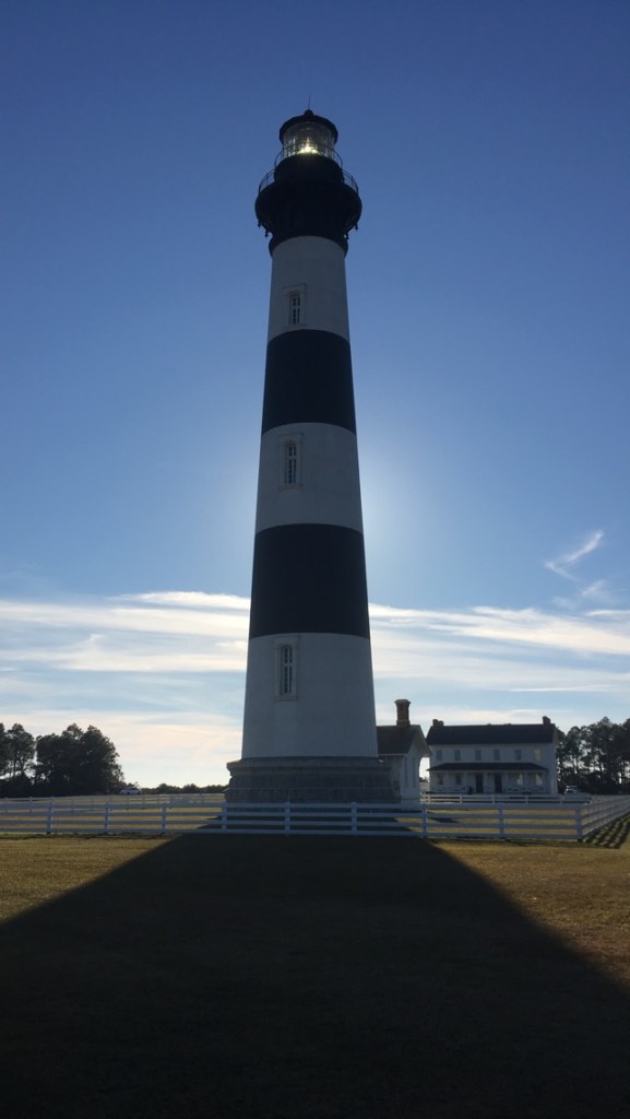
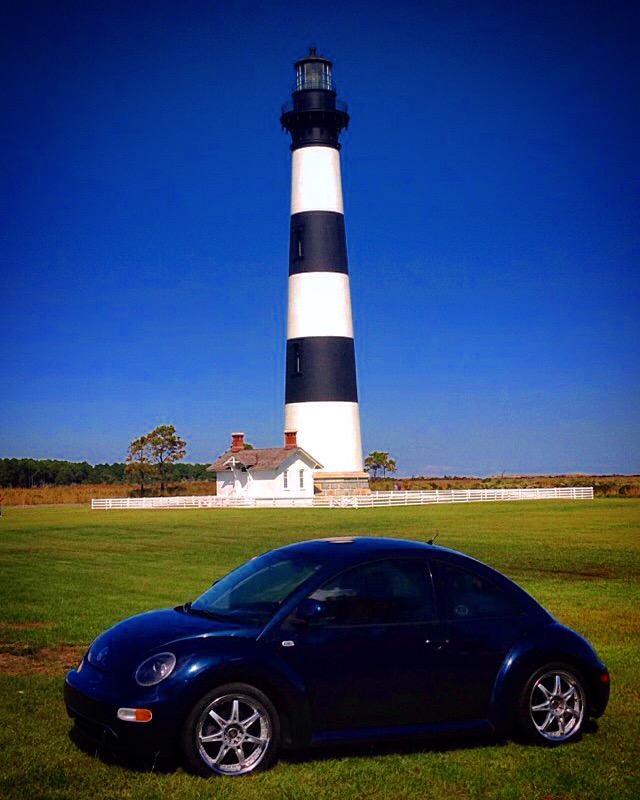
Bodie Island Lighthouse
A short 10 miles down Highway 12 and we arrived at the Bodie Island lighthouse.
“Body” or “Boh-dee”?
How did you just read that? Did you say “Body” or “boh-dee”? “Body” is what the locals will correct you to.
This is Alex’s favorite lighthouse (yes, you have to pick a favorite by the end of the tour) with its famous black and white horizontal stripes.
Take a look at their website here.
It’s simply impossible to hold back a grin as you walk up to admire it.
A Bit Deflated
We were on our way to our campsite when *pop* a flat tire. Looking back, this probably happened when we drove off the paved road to get this glamorous shot of the bug…Oops!
A friendly cop stopped to help us get back on the road quickly.
Three to go.
Outer Banks Seafood Festival
I love festivals, and in the South there seems to be a festival for just about everything. The Outer Banks Seafood Festival happened to be going on during our tour.
We were told dogs were allowed when we entered, but apparently this is not the case as we were (politely) asked to leave.
Check out the festival website here.
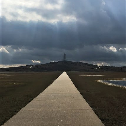
Cape Hatteras Lighthouse
We continued our drive down Highway 12 until we reached my favorite lighthouse, the Cape Hatteras Lighthouse.
You can visit the website here.
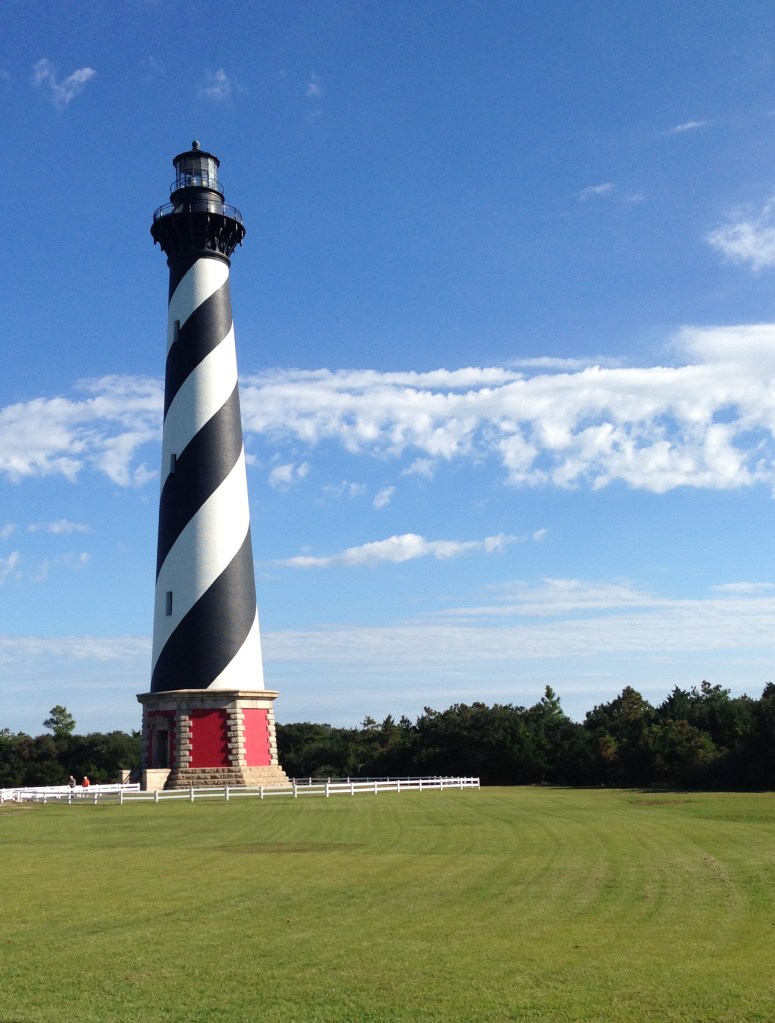
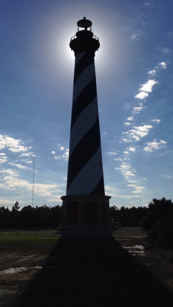
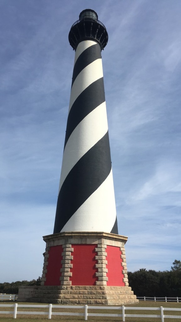
At 193 feet (198 if you include the lightning rod at the top), it’s the tallest in America, and yes, you can climb it. We wanted to, but it was too windy that day so they were not allowing people to go up.
It’s just as impressive looking from the beach:
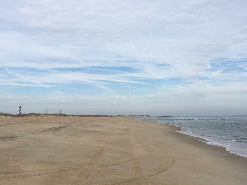
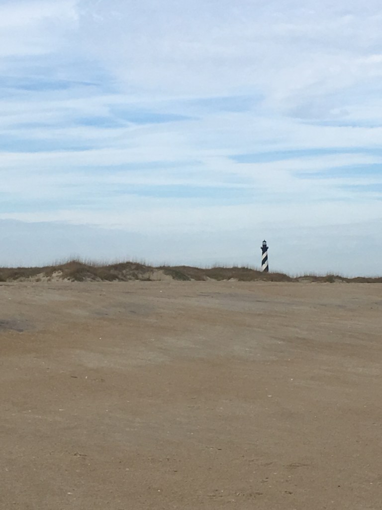
Two to go.
Next stop: Ocracoke.
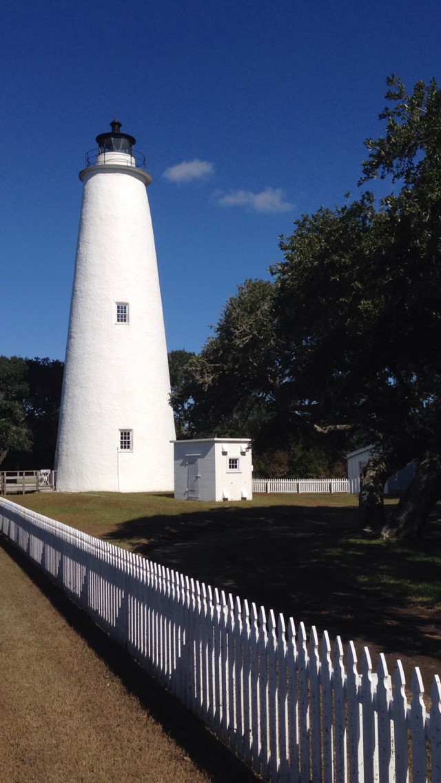
Ocracoke Lighthouse
Ferry to Ocracoke Island
You cannot drive to Ocracoke Island, it is only accessible via boat (or plane). There is a free, almost continuously running ferry that will take you from Hatteras to Ocracoke on a relaxed 40 minute ride. A short 25 minute drive south from the Cape Hatteras Lighthouse and we were at the ferry terminal.
Once on Ocracoke, we drove around and explored the island a bit (it doesn’t take too long to see most of it, the entire island is only 16 miles long.)
The Ocracoke Lighthouse was at the edge of town in an unexpected location. We drove through an old neighborhood and pulled up to what appeared to be someone’s house. Unsure about walking around the property, we proceeded around to the backyard – making sure we were respectful of the residents. A white picket fence and wooden boardwalk lead you to the base where you can view it up close.
Shorter and fatter than the rest of the pack, it’s all-white exterior is perhaps the most unimpressive of the bunch.
Blackbeard’s Safe Haven
Not to be underestimated, the area is famous for once being a safe haven for the infamous pirate, Blackbeard.
Four down. One to go.
Final Destination: Cape Lookout.
Cape Lookout Lighthouse
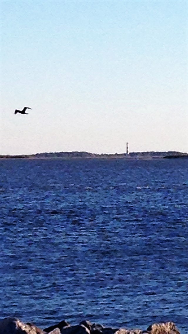
The Cape Lookout Lighthouse is the trickiest of the group to get to. The Island of Cape Lookout is completely undeveloped, and much like Ocracoke is only accessible by boat.
You can visit their website for more info here.
First, we needed to catch the Cedar Island-bound ferry, a leisurely two and a half hour ride from Ocracoke. Once on Cedar Island, we needed yet another private ferry in order to get on Cape Lookout Island. The only problem was we didn’t have enough time to catch the ferry, the next one wouldn’t be leaving until the following day. We settled on driving to the edge of Harkers Island to view the black and white diamond-patterned tower from just across the water.
We vowed that we would return and take the ferry to see it up close at a later date.
The Tour is Complete
And with that we had successfully completed our mission of seeing all five North Carolina Outer Banks lighthouses.